Throughput of Transit Vehicles

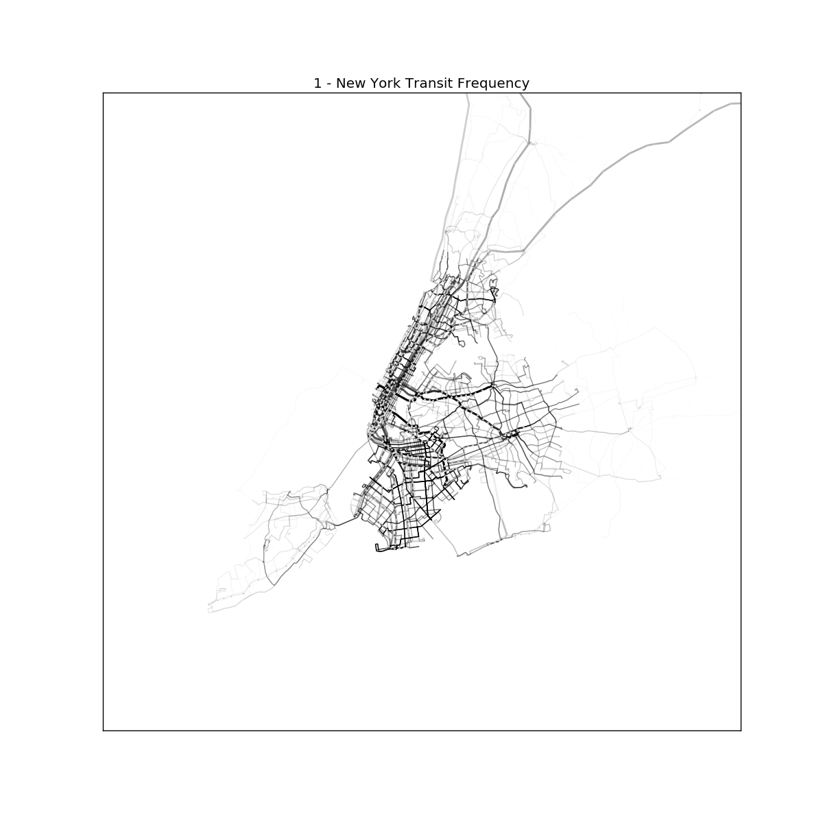
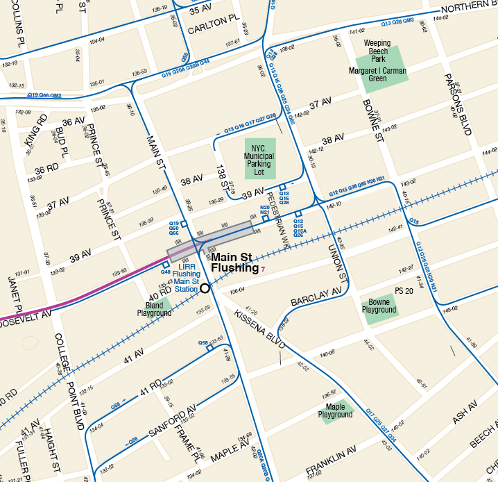
This post follows my post on the capacity of individual vehicles. To keep this post at a reasonable length, this post discusses only certain combinations of frequency and vehicles, and will be limited to combinations that would reasonably deployed in New York City.

Street running lines

This category of vehicle is defined as any line, rail or bus, that features regular intersections with traffic regulated by traffic lights. Generally speaking, the upper limit here is a vehicle every 3-4 minutes; any more frequent and you will either suffer excessive bunching as vehicles continually catch up and leapfrog each other, or require crossing gates that would be down for an unacceptable amount of time.

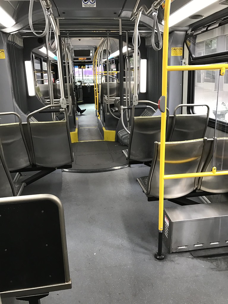
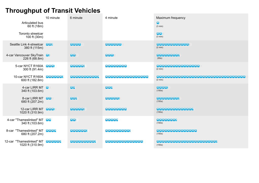
A 60 ft (18m) articulated bus running every 3 minutes (20 vehicles an hour) would carry 2400 people per hour per direction (pphd).

A 100 ft (30m) Toronto streetcar running every 3 minutes would carry 5020 pphd.

Grade separated lines

Grade separated lines are those that are completely separated from crossing traffic. This enables higher frequencies without having to worry about getting in the way of crossing traffic, or vice versa.

Seattle Link Light Rail, in its central sections, is basically a subway that happens to use coupled tram vehicles. The plan is to run, on the central segment, 4 trams coupled together measuring a total 380 ft (115m). At the planned 4 minute headway, this will be 14,580 pphd; it is possible to double this frequency for a total of 29,160 pphd.

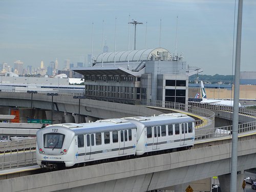
The Vancouver SkyTrain uses 113ft (34.4m) Mark II ART vehicles like those found on the AirTrain JFK. As an automated system, it has a signalling system that can handle 90s headway. At the 4-car configuration this would be 20,480 pphd.

The NYC Subway runs trains consisting of two 5-car R160A sets, each 300 ft (91.4m). A 5-car set every 10, 6, 4 and 2 minutes, this would represent 7686, 12,810, 19,215, and 38,430 pphd; and the 10-car configuration would double all these numbers.

The LIRR runs 2-car “married pair” sets 170 ft (51.8m) long characterized by generous seating and little standing room. A 4-car set running every 10, 6, 4, and at a railroad’s maximum frequency of 24 trains per hour has a capacity of 2,532, 4,220, 6,330, and 10,128 pphd. The LIRR runs these trains in up to a 12-car configuration, so these numbers would be tripled.

Thameslink is a regional rail service in London that runs fairly long train routes. It has slightly less generous seating than LIRR in a 2×2 configuration in its standard class, but has ample standing room by doors and in the aisles. Extrapolating its capacity to the LIRR’s 4-car trainset size, that would be 4495, 7591, 11237, and 17980 pphd respectively.

Notable omissions

Buses in other parts of the world, most notably South America, can run at high enough frequencies to have capacity rivalling those of high-capacity subways. However, this requires passing lanes for buses to be able to pass each other and full separation from traffic; at that point, the “bus lane” resembles a mini-highway, and the odds of blasting new highway-like roads through NYC is basically zero.

I’ve listed the maximum frequency of the subway as every 2 minutes. This is the currently scheduled maximum trains on a pair of tracks anywhere in the NYC subway; however, there are projects in the works to upgrade various lines to the same type of signalling used on the Vancouver SkyTrain. As of this writing, I am not aware of what the final capacity of the new CBTC project is, but I would imagine it’s lower than a train every 90s given the subway’s more complex service patterns and the requirement for some trains to switch from CBTC to traditional signalling and vice versa.

In the capacity post I listed bi-articulated buses and London Overground rail trains as examples of high-capacity vehicles, but throughput for these vehicles is not listed in this post. For the former, there is currently no low-floor bi-articulated bus operated in North America, and the small size of the American transit market and the vehicle’s already small niche make it unlikely to be widely used. For the latter, converting LIRR trains from abundant 3×2 seating to subway-style bench seating would be politically poisonous.

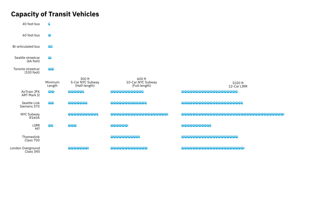
Below is an image to illustrate the relative differences in capacity.

Posted in Uncategorized

Capacity of Transit Vehicles

Often times, one of the main things that gets thrown around in bus vs rail debates is that rail has higher capacity. Is this inherently true? What does this actually look like? This is a blog post to illustrate that.

This is a general guideline for vehicles that are likely to be used in rich Western countries. Excluded from this list are things like 100% high-floor street vehicles, which are popular in South American BRTs but have generally been avoided in the developed world because level boarding then requires you to build lots of high-platform infrastructure. This is also not an exhaustive list, because I have no patience to list every possible transit vehicle that has ever existed.

Capacity in this list measures both seated people and standees. First, let’s cover vehicles intended to be used on city streets.

Buses

A standard city bus in North America is 40 feet, and a common 40 foot bus is the XD40. This bus has a capacity of ~80 people.

An articulated city bus in North America is 60 feet, and a common 60 foot bus is the XD40’s sibling, the XD60. This bus has a capacity of ~120 people.

Bi-articulated buses are common to South American BRTs, and are used in Europe, but the only current North American implementation is a future one in Quebec City. Wikipedia says a bi-articulated bus from Van Hool is 82 feet long and holds ~180 people.

Streetcars

The Inekon Trio-12 is a 66 foot long streetcar used in Seattle, that has a capacity of ~140 people.

The Bombardier Flexity that is used by Toronto is advertised by Bombardier as having a maximum capacity of 251 people at a length of 100 feet.

Limits that govern street-vehicle capacity

Buses generally have to be shorter than streetcars because they are not tied to rails, which makes steering each additional back section progressively harder. Buses also maintain the ability to swerve in and out of traffic, so bus drivers more so than streetcar drivers need to be paying attention to vehicles around and behind them, something that gets harder as a vehicle gets longer.

Streetcars can be very long, but both streetcars and buses are limited to the shortest distance between two intersections that can’t both be blocked at the same time; blocking two major intersections at a time with one vehicle would cause traffic jams.

Why do streetcars have higher capacity than buses?

1. Less seats = more room to stand.

Here is a comparison of the ~60 foot vehicles used in Seattle, which operates both streetcars and buses.

The interior of a King County Metro bus.
The interior of a Seattle streetcar.

You’ll notice that the streetcar has a lot less seating. Generally speaking, more people squeeze together standing up than sitting down. Also notice that the streetcar has a lot more for standees to hold onto.

Depending on what the goal of your transit vehicle is (are you serving mostly commuters who take long trips to downtown? Have you run out of vehicles and still need to squeeze more bodies on?) the seating vs. standing debate should be resolved for each application.

2. Door placement

In Seattle, the streetcar and some bus lines use proof-of-payment (POP) where you pay before you get on. However, the streetcar is optimized for this operation with large doors at the center of the vehicle, while buses still rely on narrower doors with awkward placements shifted for the front; this is because traditionally, buses required paying on board within sight of the driver.

For high-capacity applications, doors should be

  • wide, so that multiple people can get on and off at the same time
  • towards the center of the vehicle and equally spaced out, so that you minimize the walking distance to doors

This minimizes the amount of time that you have to spend at the stops, increasing throughput, which we will talk about in a later section.

Many operators in the US now use POP for some bus lines but the vehicles are not reconfigured to reflect this fact.

Subway-like “trains”; high-thoroughput and shorter trips

I use the words “trains” in quotes because at the end of the day, a train is basically just a bunch of individual cars coupled together that can be run without needing a driver on every single individual car.

Generally speaking, the limit of a train’s capacity is the platform length; because this is an NYC related blog, train capacity will thus show their normal length, the NYC subway length of 600 ft (and half-length of 300 ft), and the LIRR 12-car length of 1020 feet.

The AirTrain JFK is a medium capacity metro that uses ART Mark II rolling stock. At ~113 feet in length in a 2-car configuration, it has a capacity of 264 people. Extrapolated to 300 feet, 600 feet, and 1020 feet, this is a total capacity of 700, 1400, and 2383 people respectively.

Seattle Link Light Rail is purchasing S70 streetcar vehicles coupled together into 2, 3, and eventually 4 car sets. At 95 feet they carry 243 passengers each; extrapolated to 300, 600, and 1020 feet, these would carry 767, 1534, and 2609 people respectively.

The R160A is a standard trainset used in New York City’s B Division subway. A 5-car, 300 foot train carries 1281 people, and extrapolated to 600 and 1020 feet that is 2562 and 4355 people respectively.

Commuter/regional trains; longer trips that need more seating

These types of trains generally run on the “mainline” national rail network, which generally gets built with larger dimensions than standard subway trains.

The LIRR’s M7 runs in married pairs (2-car sets) 170 feet long with 211 seated passengers. Standing capacity is not available for these cars, but the 3×2 seating layout leaves almost no standing room anyways. Extrapolated to 300, 600, and 1020 feet that is 372, 745, and 1266 people respectively.

Thameslink in London runs a long regional rail network that feeds into a central tunnel in London, with some routes over 100 miles in length. The Class 700 they use has plenty of seating with a 2×2 configuration, but has room around the doors to stand, poles for standees to grab onto, and open gangways. An 8 car train exists at 531 feet with capacity for 1246; extrapolated to 1020 feet, that is a capacity of 2393 people. Keep in mind that there is also a separate first class car on these trains that generally has no standees and much larger seats; a fully standard class train would have more capacity.

London Overground is a short-distance regional rail network serving orbital routes that don’t pass through Central London. It uses all “bench” seating Class 710s, which carry 882 people on a 337 foot long train. Extrapolated to 600 and 1020 feet, that is 1570 and 2669 people respectively.

Why is the capacity of a single vehicle more important? Can’t you just throw more vehicles at the problem?

Not really. For a Western transit agency, labor is probably the most expensive part of running a transit trip. The larger vehicles are inherently more labor-efficient, up to a point; a train with two employees onboard is less ideal than one, but is still far more labor efficient than an equivalent amount of buses. (This is less true if you have a handful of collectors onboard each train just for punching tickets, like the LIRR, but that’s another article for another time.)

Where I now live, in Seattle, we have probably run into the upper limit of “how many buses can you throw at the problem”; we can no longer hire enough bus drivers to actually run the scheduled services, let alone the additional services that voters approved tax increases for, and the buses are getting caught in bus congestion despite having a four-lane street mostly to themselves. Now we are frantically building rail to try and replace buses with more labor-efficient vehicles.

Individual vehicle capacity is not the only metric, though; a line’s throughput of people per hour is also important, but that’s for another article.

And to end this, since I basically just spewed out a bunch of numbers and pictures, here’s a handy little infographic showing vehicle capacity relative to a 120-seat articulated bus.

Posted in 2020

1968: The Transit That Was Promised

Writing a comparison with Seattle’s transit now wouldn’t be useful if we didn’t also compared the past. Seattle and New York’s pasts are actually eerily similar. In 1968, Seattle voted 50.8-49.2 to build a brand new regional transit system similar to BART or DC Metro. However, the referendum needed to pass a 60% threshold, and so the system was never built and the federal money slated for Seattle instead went to Atlanta.

Likewise, in 1968 things were looking up for the MTA. As a brand new agency with a political mandate to modernize and expand transit, in 1968 the authority published a bold plan to do just that. Unfortunately for New York, at around the same time both the New York City fiscal crisis and the system’s legacy of deferred maintenance hit, and the agency went into a death spiral trying to put out those fires. But what would it have looked like if that plan had been built out?

Read more ›

Posted in Uncategorized

A Case For Transit Expansion: Seattle vs. New York

I’ve temporarily moved to Seattle for a summer internship, and it’s been quite a culture shock for a New Yorker used to 24/7 life and dirt-cheap food. Equally interesting, however, is the public transport system here. Seattle’s public transit isn’t as good as New York’s, but it can be very effective. The light rail is quick, easy-to-use, and well-kept, the fare media isn’t from the same era as the floppy disk, and transit agencies across the region cooperate and work well with each other. Granted, bus reliability leaves something to be desired because of how bad traffic is here, but for the most part the transit is pretty good for an American city.

More interesting, though, is Seattle’s continued commitment to investment and expansion of their light rail system. The regional transit agency, Sound Transit, is pushing forward a third ballot initiative in as many years to bring 58 miles of 100% grade-separated rail to the region by 2040, at a cost of $53.8B. Coming from a state where state funding of basic transit maintenance is considered a heavy political lift, this kind of regional commitment to investment is mind-blowing.

Now, a direct comparison between the two situations is a bit unfair. Seattle is an up-and-coming city with a young light-rail system, whereas New York is an old, mature city with legacy infrastructure issues. However, New York also needs to consider expansion; existing infrastructure is over-capacity, and the city is hitting growth predictions five years ahead of schedule. While we should still be funding maintenance, we should also be planning for the future.

Read more ›

Posted in Uncategorized

How Frequent is Transit in Your City?

Frequent transit maps, as described by Jarrett Walker, are very useful; you can figure out where you can just show up to a bus stop and not waste your time waiting for that once-hourly bus. They can also show you where service is concentrated, either to serve lots of people on a busy bus corridor, or to funnel riders into a particularly important destination, and can thus provide insights as to how to expand a transit network.

However, actually making them by hand, particularly for a huge operation like New York City’s MTA, or for a metropolitan area split between several transit agencies like the Bay Area, can be a huge pain, particularly if the agency doesn’t post something akin to the service guide found on the back of a New York City bus map. It’s one of the factors as to why this kind of mapping, although more useful for customers, is not very common (the other reasons including but not limited to; inertia, politics, etc.) Fortunately, many transit agencies already collect and publish information about trips, service patterns, travel times, and such using Google’s GTFS specification, so that people can plan trips using a trip planner like Google Transit. So with a little bit of Python and matplotlib, you can make a quick and dirty transit map that looks something like this:

bcfgkuh1

A frequent transit map for the New York City metro area. The darker the line, the more frequent it is.


In fact, because GTFS is a standard, it isn’t very hard to reuse the same code for other transit agencies. For example, by reusing code I was able to generate a frequent transit map for the top 20 metropolitan areas by population in the country, all mapped to the same standard and at the same scale. The code to generate this wasn’t particularly difficult at all, either.

Read more ›

Posted in Uncategorized

The Lower Montauk: The True Opportunity for Brooklyn-Queens Light Rail

Councilwoman Elizabeth Crowley has proposed a light rail reactivation of the Montauk Line, which ended passenger service in 2012 due to low usage and the cost of upgrading the line with federally-mandated PTC. Granted, usage would be low on any rail line that only saw two trains a day and ran express (real passenger service ended in 1998), so Crowley’s argument is that after almost 20 years of growth, running a dependable light-rail service would make good use of lightly-used freight tracks and be a respectively used service.

I would be inclined to disagree, if we were talking about a strict reactivation of the old right-of-way. Past Flushing Ave, the line runs entirely through industrial areas, and even if you were to rezone all of that industrial land and redevelop it (highly unlikely given the lack of manufacturing space remaining in the city,) the presence of Newton Creek, First Calvary Cemetery, the BQE, and the LIE all within a stone’s throw of the line would limit the catchment area of any stations past Flushing Av. In addition, the LIC terminus right now is not very developed; the Hunters Point South development could change that, but besides the East River Ferry the terminus misses the transportation hub at the center of LIC several blocks north.

LIC-Industrial1

The rail line in black, and developmental barriers in red.

LIC Industrial2

Long Island City Station, in the lower left of the image, is several blocks away from the nearest E, G, M, N, Q, and R stops.

Fortunately, there is an alternative; a rail line branches off at Andrews Av to head southwest towards Williamsburg.

Lower-Montauk-Light-Rail

Such a connection would run on the existing spur line to Bushwick Pl, where the light-rail would run on Montrose Av, Division Av, and Kent Av before terminating at the East River Ferry pier in Williamsburg. A routing on Kent Av would allow connections with the East River Ferry and the planned BQX; but if the routing were to have a negative impact on the Brooklyn-Queens Greenway and the BQX were not to proceed, the line could instead terminate at Roebling St.

Stations were sited to provide maximum connections to the existing transit network and destinations along the way. As far as other potential sites go, there is no station connecting to the Myrtle Av Line because it would not be feasible to build an intermediate station for connections and there is nothing in the immediate area of that rail junction to serve. Likewise, there are no stations between Bushwick Av and Fresh Pond Road because that area is both mostly industrial and a high flood-zone risk; it might not be beneficial to support development in such a flood-prone location. Ultimately, because the station spacing is so sparse, the line could potentially function as an express connection between Jamaica and Williamsburg, in contrast to the frequently-stopping slog that is the J. Because Williamsburg is so much more heavily built up than LIC (and short of ripping up the highways and cemeteries or filling in Newton Creek, will continue to be so), such a line would be better patronized and spur more development than a line to LIC.

Posted in Uncategorized

Flawed Proposals: Off-street Bus Terminals

Once in a while, someone will suggest a bus terminal in Flushing as the solution to the chronic bus and traffic congestion in Flushing. It sounds like a nice idea; separating buses and cars is bound to make both faster. However, these proposals are generally horribly misguided, for a variety of reasons. The latest one, for a bus terminal west of Prince Street, manages to get everything wrong, by moving it as far from the existing subway complex and retail hub as possible. This location makes absolutely no sense; the station’s facilities are all to the east, including a new eastern entrance that was built in 1999 to relieve crowding at the existing western entrance.

In general, I am opposed to an off-street terminal for largely two reasons:

1. In New York City, off street bus terminals, especially those run by the MTA, tend to be pedestrian dead zones.

Off street bus terminals exist in the five boroughs; the 165 St terminal and Williamsburg Bridge Plaza are notable examples. However, they tend to be located in out-of-the-way locations where transfers may not be convenient; for example, the 165 St terminal is located a full three blocks away from the nearest subway entrance. Where they do exist, they tend to create huge dead zones in otherwise thriving neighborhoods. This is excusable at Williamsburg Bridge Plaza, which is right next to the bridge’s highway-like approach; this is less appropriate at Jamaica, and completely inappropriate in a thriving neighborhood like Flushing. The addition of a giant pedestrian dead zone to Flushing would either kill the development already occuring, or stymie the development that DCP is trying to generate in Flushing West.

DCP is hoping to get around the issue by enticing a developer to cap a bus terminal with a mixed-use development. This approach is used in Hong Kong to try to reduce the impact of bus terminals on the surrounding neighborhood. However, keep in mind that Hong Kong has extremely high property prices, reaching above thousands of dollars per sq ft; property prices in Flushing are certainly high, but nowhere near those levels. Combined with the hard height limits in Flushing West due to LaGuardia Airport nearby, it might not be possible to entice developers to build both a bus terminal big enough for all of Flushing’s buses, and a development as well.

2. Bus terminals may not actually end up reducing congestion.

If you look at where they’re proposing to build another bus terminal, it is in the north and west. Let’s take a look at this diagram:

Flushing-Diagrams

As you can see, the overwhelming majority of bus traffic comes from the south and east, via Kissena Blvd. To get to somewhere north of Roosevelt Av and west of Prince St, all of these buses would have to cross not only Main St, but Roosevelt Avenue, and going northbound would have to make a left at some point. All of these buses would still be going through the most congested area bar some serious rerouting, and due to all the additional turning movements would cause additional congestion.

A good example of where turning movements cause too much congestion is the parking lot of the New World Mall located at the intersection of 40th Road and Main St in downtown Flushing. Theoretically, a parking lot for the New World Mall should ease congestion; if all the drivers visiting the mall have a guaranteed free parking space, that reduces congestion from mall-bound drivers who circle the block looking for free parking. However, because the cars are turning in a heavily trafficked intersection and must wait for breaks in pedestrian traffic to do so, the parking lot ends up causing more congestion than there should be.

This project was proposed by an anti-bus business elite in Flushing, as Cap’n Transit asserts. However, if done correctly, a bus terminal could potentially reduce bus congestion and car congestion in Flushing, without necessarily compromising transfers.


The Ideal Flushing Bus Terminal: The Union St Parking Garage

FlusshingCurrent

The Union St Parking Garage is bounded by 37 Av, 138 St, 39 Av, and Union St. As a parking lot, it’s ripe for redevelopment, and a bus terminal, especially with development on top, would be perfect. It’s a better location for this than the DCP location, because unlike Flushing West it is located in an already vibrant section of Flushing, and height limit restrictions are probably more negotiable because it’s farther away from the airport. On top of that subway entrances do exist as far east as the pedestrian walk that cuts to the Union St Parking Garage, so it’s not even that much farther from transit.

Unfortunately, the best option isn’t available because redevelopment of the parking garage is already underway. However, we can still reroute some of the bus routes through the area, like so:

FlushingNew

The key to this plan is rerouting all Main St bound bus traffic from Kissena Blvd onto Barclay Av and Union St, since the merge from Kissena Blvd onto Main St is currently the biggest cause for delays in the area. Barclay Av is lightly trafficked and would be converted to two-way, bus only operation between Kissena Blvd and Union St. The Q17 and Q27 would terminate along 138 St, while the Q25, Q34, and Q65 would stop on Union St before heading north and turning left on 35 Av to reach their existing routes, since lefts from Union onto Northern aren’t really possible.

The farthest buses in this plan from the subway are as close as the closest buses under a Flushing West plan (Prince St is as far from the westernmost entrance as Union St is from the northernmost entrance), and distances for some riders could be shortened further by creating a small pedestrian walkway between 138 St and Roosevelt Av. Not only is it more convenient for passengers than the current proposal, but it is easier to implement; all the traffic changes here, save Barclays Av, use traffic patterns already used by buses that go through the area, whereas going through Flushing West would require creative rejigging of routes; there isn’t currently an easy way to route a lot of buses from west of Main St to east of Main St south of Northern Blvd that doesn’t miss most of the dense neighborhood.

By locating it at the Union St Parking Garage site, you place passengers in a more developed, pedestrian friendly section of Flushing, as well as activate the current development going up on the parking garage site. Riders won’t be significantly farther from the subway, and speeds should increase for routes no longer using Main St. It’s definitely cheaper than the other option, which is to build some sort of tunnel for either light rail or bus underneath Main St.

Posted in Uncategorized

The New Second System, Revised

After publishing my proposal for subway expansion, I received feedback on the plan. Some of it was constructive, and got me thinking, so I revised the proposal in order to improve it. Most of the adjustments were in the Bronx, but there were some small ones in Queens as well.

Future-Subway-Map-Bronx-Revised

In the Bronx, the (A) is curtailed to Fordham Plaza, where a convenient cross-platform interchange would be built. The (A) to Bay Plaza would add way too much mileage to the longest route in the system, and if the transfer is convenient enough, it would be just as good as one continuous Pelham Pkwy/Fordham Road Line.

The second part of the revision is a link from 145 St on the Lenox Avenue Line to 161 St – Yankee Stadium on the Jerome Avenue Line. Something like this was actually planned in the early days of the TA using the former 9th Av Elevated ROW. As part of this, 148 St would be closed, also providing a future possible home for the Transit Museum. This would allow for the doubling of Jerome Avenue service, allowing Jerome Av peak express services while also reducing transfer volume at 149 St – Grand Concourse. The boosting of this service would provide more service to the corridor and points west, thus reducing the need for a University or Sedgwick Avenue Line.

Future-Subway-Map-Queens-Revised

As noted by vanshnookenragen, it would be significantly easier to make a 73 Av Line via the Jamaica Yard. This has been depicted in the map shown, although I have my doubts about whether or not you could do it without significantly harming yard operations. The 73 Av Line is also extended two stops east, to Francis Lewis Blvd and Springfield Blvd. Francis Lewis Blvd is definitely a worthy terminal stop; the cost-benefit of Springfield Blvd station (or Bell Blvd instead, which is denser but has poorer bus connections) is dubious given the very low-density nature of the neighborhood. However, the relatively close distance of Union Tpke and the overcrowded Q46 ensures at least some level of high ridership, and it is also a faster trip to take a train from Springfield/73 to Forest Hills than to take the bus to Springfield/Hillside and the train from there due to the wider stop spacing and the lack of stops between Main St/73 Av and Forest Hills.

Posted in Uncategorized

The Second Avenue Subway as part of a new Second System

Future-Subway-Map

In my previous post, I described a “core” expansion that would relieve the Lexington Avenue Line in Manhattan, the Queens Blvd Line in Queens, and the Jerome Av and Grand Concourse Lines in the Bronx. This new Second System would relieve services enough to embark on a new series of expansions in the outer boroughs that would relieve congested bus corridors, and shorten commute times for outer borough commuters by a significant amount.

The Bronx

Future-Subway-Map-Bronx

The new Second System would see very minimal expansion in the Bronx. Most north-south travel needs would be met by the existing network, the Third Av/Pelham Pkwy Line, and the planned Penn Station Access project in the East Bronx. Coupled with the fact that there is no available north-south capacity from the new “core” system or the existing system to extend north, that would mean no new north-south lines within the Bronx.

However, a new extension of the A to Fordham Plaza would run east, using the yard tracks into the 207 St Yard, crossing the river using a bridge, and then tunneling into the ridge before traveling under Fordham Rd to Fordham Plaza. This would replace the western half of the busy Bx12 Select Bus route, connecting the A to the 1, 4, D, and Metro-North, and the new Pelham Pkwy line to Co-op City. At Fordham Plaza, the line could either terminate at a middle platform built at the station, or merge into the Pelham Pkwy line and continue on to Bay Plaza.

Side note: due to the use of the 207 St Yard tracks, trains would turn off just before Dyckman St. As a result, Inwood-207 St could potentially be shut down if the MTA desired to do so, and used for train storage or as a relocation of the Transit Museum, which the “core” connection between Hanover Square and Court St would’ve displaced.

Queens and… Nassau?

Future-Subway-Map-Queens

The “core” system would relieve the overcrowded Flushing and Queens Blvd lines by either taking over railroad rights-of-way (in the case of the Port Washington Branch) or by constructing lines parallel to them (in the case of the Main Line.) While the takeover of the Port Washington branch would give subway service to Northern Queens and Nassau immediately, the Second System would be needed to fully utilize the capacity freed up by the Queens Blvd Bypass, which would link the 63 St tunnel to Forest Hills, taking over local service east of Forest Hills to 179th St. Using this new capacity, nearly all the lines currently terminating in Forest Hills and Jamaica could be extended.

Illustration of current and future Queens Blvd & Bypass services.

Illustration of current and future Queens Blvd & Bypass services.

The local Queens Blvd lines would also be extended, but for different reasons. Currently, both terminate at Forest Hills, but the service run on these lines is limited by the need to fumigate passengers at the end of a line. One of the local lines would be extended south to meet the deactivated Rockaway Beach Branch ROW, running south before terminating at Howard Beach – JFK Airport. This would provide a valuable north-south connection in Queens, as well as provide faster midtown access than the current A train. The other local line would be extended east of Forest Hills via 73 Av to 188th St. While bus service past 188th St continues to be intense, extension east would be complicated by the slow speed of the local train. (It doesn’t matter which local service gets extended where, but for the sake of argument let’s suppose that the M goes to Howard Beach and the R goes to 188th St.) This would decongest the situation at the existing terminal, but if either extension occurred Woodhaven Blvd on the Queens Blvd line would have to be converted to an express station; even today, Roosevelt Av gets too crowded from people transferring from the east, and the extension of the local lines would only make it worse.

The express Queens Blvd lines would be extended both east and south. The F would be extended down Hillside Avenue to Springfield Blvd, while the E would turn south and join the LIRR ROW directly south of the existing station paralleling the existing tracks to Springfield Blvd, as the 1968 Program for Action called for. Both would make stops at streets with major bus routes, providing quick connections to the bus network while obviating the need for many bus lines to divert into Jamaica. This would allow for a rationalization of the bus network in both eastern and southern Queens. Either could be extended to Nassau and terminate at a major hub (North Shore LIJ for the F, and either Valley Stream LIRR or Green Acres Mall for the E), but I would consider that too expensive and too extensive to include in this Second System.

Brooklyn

Future-Subway-Map-Brooklyn

In the “core” expansion, a Utica Av line would be built, extending the 4 south to Avenue H and eventually Kings Plaza. This line would then be connected to the Second Avenue trunk via Williamsburg and the Lower East Side, giving one of the two major subway-free corridors in Brooklyn a subway line. As part of the new Second System, the Nostrand Avenue line would also be extended south to Avenue U. No other major expansions would occur, except the Triboro RX.

Triboro RX

Future-Subway-Map-Triboro

This is included as part of the Second System mostly because it would be cheap to construct. There are two versions of the plan that have been pushed, differing in how they travel through the Bronx. One would use an abandoned railway line to connect to the 6, the 2/5, and eventually the B/D and 4 at Yankee Stadium, while the other would run along the Amtrak ROW to Hunts Point and Co-op City. I don’t like either option; the former has poor connections to some of the subway lines it crosses and doesn’t connect to many more of them, while the latter doesn’t even intersect subway lines. In fact, I don’t really support the notion of the Triboro RX going into the Bronx at all; it would needlessly make the circumferential arc too wide while suboptimally connecting to lines in places that do not currently support a lot of Bronx-Queens travel. (There was formerly a bus line across the Triboro between the Bronx and Queens, but it was discontinued due to low ridership.) Instead, I would rather have the line turn west at Randall’s Island and connect to the 125th St spur of the Second Avenue Subway. It would provide quick, easy connections to all of the north-south lines, and for the majority of people it would not significantly increase circumferential travel time.

Ultimately, I believe that these expansions would be suitable for New York for the next fifty or hundred years. After this expansion, focus should be shifted to building a robust surface network, whether or not it is light rail, BRT, or streetcars. This will be detailed in a later post.

Posted in Uncategorized

Second Avenue: The Key to Future Expansion

The Second Avenue subway has been the aspiration of New York’s transit planners for the better part of a century. Originally envisioned as a massive trunk line that would be six tracks wide at its largest point, the current plans only call for a short “stubway” between 96 St and the Broadway Express at Lexington Av and 63 St, with future expansions north and south to be completed in the future. At first glance, the project seems like it isn’t enough; a third track at 72 St was omitted, and there are no express tracks planned for the line. However, two tracks is more than enough to provide core capacity for future expansions.

Why We Don’t Need Express Tracks

New York is unique, at least in the West, in having such a complex, extensive system of express and local lines. The system allows for a large amount of branches to converge into a tight, dense core; if the five north-south trunks were unbundled into ten north-south pairs, crosstown lines like the 7 and the L would have to make impossibly close stops to connect to all the north-south lines. In light of the fact that all the Manhattan trunk lines have express tracks, it can seem lile the Second Avenue Subway is not enough, especially when you consider that it’s meant to relieve a four-track trunk that carries more passengers than several North American systems combined. However, in this day and age, constructing express tracks is more trouble than it’s worth. Gone are the days where entire streets were ripped up and laying two or four tracks was only restricted by street width; four tracks means four TBM drives, doubling tunneling costs. Express tracks would also require bigger stations, something to avoid in a project where the most expensive parts are the stations themselves. Even if express tracks are built, they wouldn’t be particularly useful; you wouldn’t be saving a lot of time traveling from 125 St to Hanover Square, and the planned pair of tracks can actually handle quite a bit of traffic, as shown in the diagram below: SAS-possible-capacity In the following paragraphs, I will elaborate further on the possible expansions if the core system is built as planned.

Expansion to the North and West

The planned northern terminus of the line is at 125th and Park Avenue, with tail tracks for future expansions located as far west as Lenox and as far north as 129th and Second. This differs from previous plans, which had termini in either the Bronx or at 125th and Second. The proposed location does limit the Bronx to one new SAS service instead of two, but there isn’t enough money at this time to terminate in the Bronx, and 125th and Second is a poor location for a terminal; the area is at a higher risk of flooding, and the ramps for the Triboro Bridge start there, causing increased danger for pedestrians and potential subway riders while reducing potential development opportunities. (Note: It is assumed that two is the maximum number of services that a pair of tracks can reliably handle. Where three services run on a pair of tracks in the system, such as the 60th St tubes, congestion and cascading delays are not uncommon.)

The logical western extension would be to the West Side via 125th St. 125th St is currently a very busy, slow crosstown corridor; a crosstown connection would help redistribute traffic from the Bronx and northern Manhattan amongst the trunk lines, and would speed up commutes for many. Two options for termini exist: 125th and Broadway is the most logical one, and would provide connections to the 1 and a potential Penn Station Access station for Metro-North. Another possible terminus would be a deep-level platform at 116 St-Columbia University on the 1, to provide access to the university and potentially allow for a southern extension down the West Side.

To the north, there are three logical extensions to make, following either the Harlem Line, the Hudson Line, or the future Penn Station Access right-of-way. Of these, I would prefer to extend it via the Harlem Line ROW; since the area lost the Third Av El around it in the ’70s, the lines around it have become crowded, and restoring subway service would ease the pressure on these trains. Such a line could be built in three phases; from the existing tail tracks to 3 Av – 149 St via Third Av; from 3 Av – 149 St to Fordham Plaza; and from Fordham Plaza to either Gun Hill Road on the 2/5, or east via Pelham Parkway to Co-op City at Bay Plaza, possibly combined with an extension of the 6. The former would restore the old Third Av El’s full route, while the latter would serve as a vital crosstown connection across the Bronx that currently doesn’t exist, and would relieve one of the busiest bus routes in the system. SAS-North-West

The 63 St Turnouts

The Second Avenue Subway, in its first phase, will connect Second Avenue to the Broadway Express going north to west. The third phase will provide a turnout connecting Second Avenue to the 63 St Tunnel’s upper level, going from south to east. The plans from the 1970s called for connecting the 63 St Tunnel to either Forest Hills or Jamaica via the LIRR’s Main Line Row, but the plans were scaled back, resulting in the current 63 St Tunnel and Archer Avenue Line stub. Any Second Avenue service would require a new pair of tracks along the Main Line, which has room for at least six tracks to Rego Park. and a tunnel from the 63 St upper level to the Main Line route. Fortunately, the latter already exists, as evidenced by this excerpt from the East Side Access EIS:

ESA-NYCT

As for the pair of tracks, there would be two options. The first would be to build a pair of tracks from Long Island City to a stop on the Main Line at Rego Park via Woodside, then tunneling under Yellowstone Blvd to reach Forest Hills, connecting to the local tracks. A Second Avenue service running local from Forest Hills to 179 St would allow the F to stay on the express tracks east of Forest Hills, increasing reliability, decreasing travel times, and would pave the way for a long term extension east of 179 St; current service takes too long for extension east to be feasible. However, this plan has a major drawback – all space on the Main Line ROW between Long Island City and Woodside is taken up by the six existing LIRR tracks, so some land acquisition would be needed.

The second option would be easier from a technical standpoint, but significantly harder politically. Connecting the Port Washington branch to the 63 St upper level would require minimal new construction for significantly improved service to Corona, Eastern Queens, and Western Nassau; stations at Elmhurst (Queens Blvd & Broadway) and Corona (Junction Blvd & 108 St) would serve areas currently only serviced by overcrowded, slow feeder buses to the subway, and a grade crossing at Little Neck would have to be removed. The current Auburndale LIRR station could also be replaced by two stations at Utopia Pkwy and Francis Lewis Blvd to provide better bus connections. However, the main difficulty would be NIMBYism; it’s unclear whether even a fairly dense Nassau neighborhood such as Great Neck would be okay with the replacement of LIRR service with subway service, to say nothing of the more suburban communities east of Great Neck. If it were doable, it would be cheap, and would also make future core expansion cheaper; a short elevated line from the Astoria Line east of Queensboro Plaza to the PW tracks would provide the cross-river capacity to build the Queens Blvd Bypass. SAS-East

Expansion to the South

The current plans call for a set of tail tracks south of Hanover Square as provisions for extension to Brooklyn. The most logical, cheap connection would be to the Fulton Line via the former Court St station, which currently functions as the Transit Museum. If this were to happen, it would allow for a reorganization of Fulton St service; all Eighth Avenue services would run express past Hoyt St, with C trains going to Lefferts Blvd and the A alternating between Far Rockaway and Rockaway Park, while Second Avenue trains would all run local to Euclid. This would reduce switching and improve reliability, and the provision of East Side service on the Fulton St line would also reduce loads on the Brooklyn IRT, which currently provides the only East Side service in Brooklyn. The decrease in crowding would allow for the expansion of IRT service to Nostrand Av and Av U, and the extension of the 4 down Utica Av to Kings Plaza.

In the future, it would be possible to use the storage tracks on Second Avenue between 21 and 9 Sts to provide an additional link to Brooklyn via the LES, Williamsburg, and Stuyesant Av, connecting to the Utica Av Line. Such a route would have to be studied more in depth, since the street network in the area isn’t straight, and the Second System plans for this line would require bulldozing a path for a new street. (Due to the way the Utica Av IND station is setup, a connection to the Fulton local tracks would be impossible, although it would be cheaper than a new line through Williamsburg.) SAS-Brooklyn As described above, the SAS provides more than enough core capacity to relieve significant sections of the subway, even without express tracks. This relief would also allow for the extension of existing overcrowded subway lines, to be detailed in a future post.

Posted in Uncategorized